Convert geographic coordinates between decimal degrees, DMS, decimal minutes, and WGS84 UTM zone, easting, northing, and EPSG-style projected CRS outputs.
Last updated
Coordinate format converter Translate the same location between decimal degrees, DMS, decimal minutes, and WGS84 UTM coordinates, then copy the format that fits your GPS, map, spreadsheet, or GIS workflow.
Input mode
Presets
Datum note
This converter treats the result as WGS84-style geographic coordinates. Changing datum or reference frame is a separate geodetic transformation.
UTM coverage
UTM works from 80°S to 84°N. Locations outside that band still convert between decimal and DMS, but they do not have a standard UTM zone output.
Enter coordinates Provide a decimal-degree, DMS, or UTM coordinate to see every supported representation side by side.
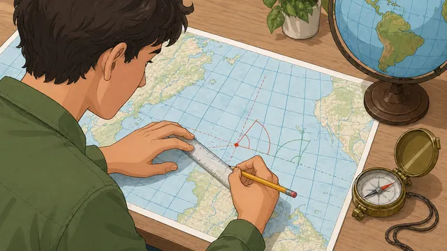
Coordinates converter: decimal degrees, DMS, decimal minutes, and UTM explained
A coordinates converter rewrites one geographic position in the format expected by a map, GPS workflow, field note, or spreadsheet. Decimal degrees are compact for software, DMS remains common in navigation and manual entry, and UTM adds zone-based easting and northing values that many mapping workflows prefer.
One location, several valid formats
Decimal degrees express latitude and longitude as signed decimal numbers, while DMS breaks each degree into minutes and seconds. Decimal minutes sits between them by keeping whole degrees and expressing only the minutes as a decimal.
Those are just different ways to write the same geographic angles. Converting between them changes the notation, not the underlying position.
For most web maps and spreadsheet work, a latitude longitude converter that returns signed decimal degrees is the fastest handoff. For field notes, chart references, or older GPS instructions, the same point may need degrees-minutes-seconds or degrees and decimal minutes.
Converts a DMS latitude or longitude into decimal degrees.
1° = 60′ = 3,600″
Shows the subdivision relationship behind DMS notation.
What UTM adds
UTM projects the earth into numbered longitudinal zones and reports position as easting and northing within that zone. That can be easier for some field workflows because the values look like planar map coordinates rather than signed angles.
UTM is never complete without both the zone and the hemisphere. The same easting and northing can point to very different places if the zone changes, and the numbers can also shift when the datum changes.
A lat long to UTM converter should therefore show the zone, band, hemisphere, easting, northing, and projected CRS context together. If someone gives you only two metre values, ask for the missing zone and datum before using the coordinate.
How to choose the output format
Use decimal degrees when the receiving system expects a compact pair such as 40.446111, -79.982222. Use DMS when a form asks for degrees, minutes, seconds, and hemisphere letters. Use decimal minutes when the workflow keeps whole degrees but stores the minutes as a decimal.
Use UTM when a mapping, GIS, engineering, or field-data workflow is already set up for a projected zone. The copy-ready output in this coordinate converter keeps the common formats visible together so you can compare them before pasting the result into another tool.
Display precision is a presentation choice. More decimal places can preserve finer detail when copying coordinates, but rounding a displayed value does not create survey-grade accuracy if the original coordinate was approximate.
When conversion alone is not enough
This tool converts coordinate format and, for UTM, uses a WGS84-style Transverse Mercator relationship. It does not perform datum transformations between systems such as WGS84 and NAD83, and it does not decide which projected zone is appropriate for a multi-zone workflow.
That distinction matters near zone edges, in cross-border projects, and in any workflow where another system specifies a different datum or coordinate reference frame.
NOAA NGS — UTM service — Official NOAA UTM reference documenting zone, hemisphere, easting, northing, and datum expectations.
Frequently asked questions
Are decimal degrees and DMS different coordinates?
No. They are different notations for the same latitude and longitude. If the hemisphere or sign is preserved correctly, the physical location stays the same.
Why do UTM coordinates need a zone?
Because UTM uses separate projected zones across the globe. Easting and northing are only meaningful within the correct zone and hemisphere.
Does converting to UTM also change the datum?
No. Format conversion and datum transformation are separate steps. The same point can have different UTM numbers under different datums even though the zone label looks similar.
Why is there no UTM result for some polar locations?
Standard UTM covers 80°S to 84°N. Locations outside that band use polar mapping systems rather than the standard UTM zone structure.
What is the difference between a coordinates converter and a coordinate distance calculator?
A coordinates converter rewrites one point in another notation, such as decimal degrees to DMS or latitude longitude to UTM. A coordinate distance calculator compares two points and estimates the distance, bearing, or midpoint between them.
Can I convert UTM back to latitude and longitude?
Yes, if you know the UTM zone, hemisphere, easting, and northing. The reverse conversion returns the matching latitude and longitude under the same WGS84-style assumptions used by this tool.
How many decimal places should I keep for latitude and longitude?
Keep enough decimals for the task and avoid implying more precision than the source has. Four decimal places is rough neighbourhood scale, five to six can be useful for many GPS and map workflows, and higher precision should come from a reliable original source.